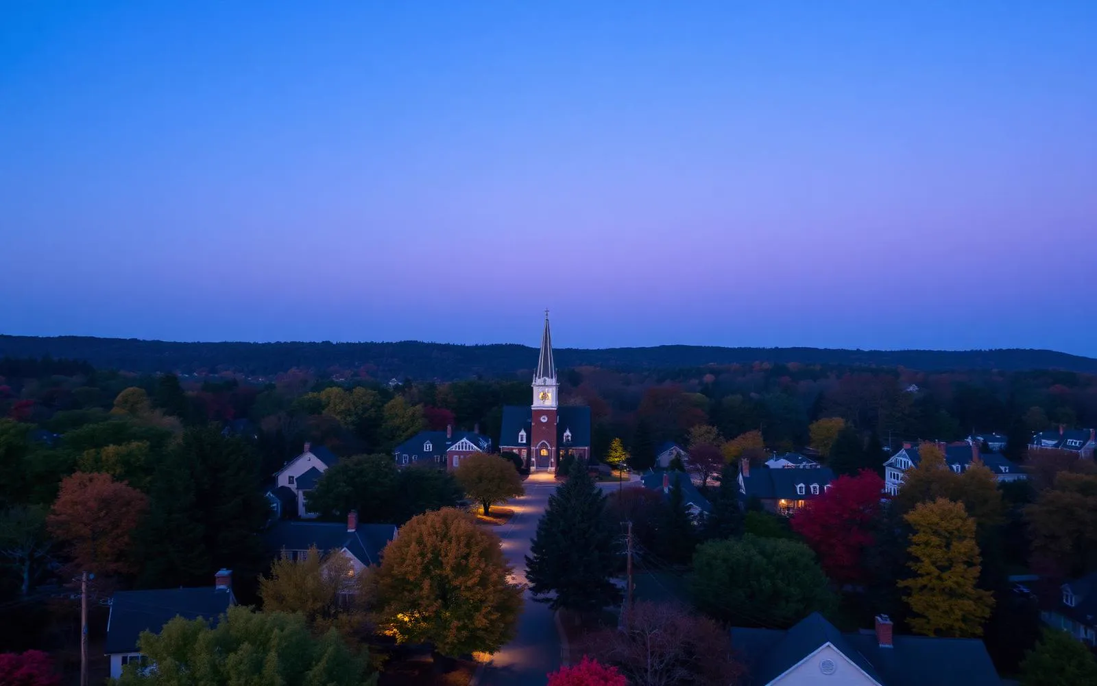
Discover Waxhaw
A constellation of towns.

The Region

A constellation of towns.

Waxhaw doesn't sit alone. Fifteen neighboring towns, villages and districts — across four counties and two states — each contribute their own character, tax base, and school district to the greater region.

Towns near Waxhaw, NC — a town-by-town guide

What outsiders call "Waxhaw" is really a tight cluster of historic towns and incorporated villages spread across southern Union County — each with its own town hall, school catchments, zoning DNA, and identity. Six of the sixteen entries below sit outside Union County entirely, and the differences in taxes and school assignment are the reason buyers who never intended to compare towns end up doing exactly that.

At a glance

Sixteen towns, side by side

Population, county, school district and incorporation year for each town near Waxhaw, NC
TownCountyPopulationSchool districtStatus
WaxhawUnion County, NC22,400 residentsUnion County Public SchoolsIncorporated 1889
MarvinUnion County, NC7,800 residentsUnion County Public SchoolsIncorporated 1994
WeddingtonUnion County, NC14,300 residentsUnion County Public SchoolsIncorporated 1983
Mineral SpringsUnion County, NC2,800 residentsUnion County Public SchoolsIncorporated 1989
Wesley ChapelUnion County, NC9,400 residentsUnion County Public SchoolsIncorporated 1998
Indian TrailUnion County, NC41,000 residentsUnion County Public SchoolsIncorporated 1907
MonroeUnion County, NC36,000 residentsUnion County Public SchoolsIncorporated 1843
MatthewsMecklenburg County, NC32,000 residentsCharlotte-Mecklenburg SchoolsIncorporated 1879
StallingsUnion County, NC17,000 residentsUnion County Public SchoolsIncorporated 1975
Indian LandLancaster County, SC35,000 residents (unincorporated)Lancaster County School DistrictUnincorporated — Lancaster County, SC
BallantyneMecklenburg County, NC40,000 residents (Charlotte community area)Charlotte-Mecklenburg SchoolsPart of the City of Charlotte — not separately incorporated
PinevilleMecklenburg County, NC10,500 residentsCharlotte-Mecklenburg SchoolsIncorporated 1873
Mint HillMecklenburg County, NC28,000 residentsCharlotte-Mecklenburg SchoolsIncorporated 1971
Fort MillYork County, SC34,000 residents (town limits)Fort Mill School District (SC)Incorporated 1873
UnionvilleUnion County, NC7,200 residentsUnion County Public SchoolsIncorporated 1998
Lake ParkUnion County, NC3,600 residentsUnion County Public SchoolsIncorporated 1994

Population figures are rounded estimates drawn from U.S. Census Bureau and municipal reporting; school assignment is set by district attendance boundaries and must be verified for an individual address.

Incorporated 1889

Waxhaw

≈ 22,400 residents

Union County, NC

ZIP 28173

The cultural and commercial anchor of southern Union County — a 19-block historic district wrapped in the metro's densest concentration of gated estate communities.

Waxhaw is the town everyone in the corridor means when they say "out toward Waxhaw." It sits roughly twenty-five miles south of uptown Charlotte, straddling the Union County line with a thin edge reaching into Lancaster County, South Carolina. What began as a railroad depot town in 1889 has become the retail, dining, and civic center for a cluster of villages whose combined household incomes rank among the highest in North Carolina.

  • ·Downtown Waxhaw's antique-shop economy is the oldest continuous retail identity in the county; dealers have occupied the same storefronts for decades.
  • ·The town calendar is dense — Kingsley farmers markets, the Waxhaw Autumn Treasures festival, Christmas parade, and a downtown concert series keep the district busy nearly year-round.
  • ·Municipal zoning has deliberately preserved low-density land outside the core, which is why horse pasture still meets subdivision fence line inside town limits.

Incorporated 1994

Marvin

≈ 7,800 residents

Union County, NC

ZIP 28173

A deliberately planned village of five-acre minimums, pastoral setbacks, and one of the highest median household incomes in the Carolinas.

Marvin was incorporated in 1994 for a single reason: to control what would be built on it. Residents watched Charlotte's growth arrive at the Mecklenburg line and chose density limits over tax base. Thirty years later the decision is visible from any road in the village — long white fence lines, pasture between houses, and almost no commercial signage.

  • ·Much of the original village carries five-acre minimum lot sizing; even later subdivisions were platted at densities far below county norms.
  • ·There is effectively no commercial core — residents shop in Waxhaw, Weddington, or Ballantyne, which is by design.
  • ·Marvin Efird Park anchors civic life with trails, ball fields, and the village's community events.

Incorporated 1983

Weddington

≈ 14,300 residents

Union County, NC

ZIP 28104 / 28173

Estate-scale lots, a top-tier high school, and the steady favorite of established families relocating from out of state.

Weddington is the corridor's establishment town. Incorporated in 1983, it grew as a low-density residential township with almost no commercial zoning, and it has spent forty years defending that pattern. The result is a town of one-acre-and-up lots, cul-de-sac neighborhoods that alternate with horse pasture, and a civic culture organized largely around its schools and its creek.

  • ·The town has minimal commercial development by ordinance; residents shop the Waxhaw, Wesley Chapel, and Ballantyne corridors instead.
  • ·Weddington High School is a perennial NCHSAA athletic power as well as an academic standout, and school identity drives much of the town's social calendar.
  • ·Significant overlap exists with the Providence Country Club and Longview community footprints, blurring the line between Weddington and Waxhaw addresses.

Incorporated 1989

Mineral Springs

≈ 2,800 residents

Union County, NC

ZIP 28108 / 28173

The smallest of the cluster — a deliberately rural village that protected itself from sprawl and kept its farmland intact.

Mineral Springs incorporated in 1989 for defensive reasons: the village wanted control over its own zoning before Charlotte's growth reached it. It worked. Three decades later, the village remains overwhelmingly agricultural — hay fields, tree lines, gravel drives, and parcels measured in tens of acres rather than tenths.

  • ·Most properties exceed three acres and many exceed ten, a pattern almost impossible to find this close to a major metro.
  • ·The Mineral Springs saddle club community and its annual hunter pace draw riders from across the region.
  • ·Cane Creek Park sits at the village's eastern edge — camping, fishing, paddling, and disc golf on a 350-acre lake.

Incorporated 1998

Wesley Chapel

≈ 9,400 residents

Union County, NC

ZIP 28104 / 28173

The corridor's family entry point — top Union County schools and newer master-planned neighborhoods without estate-level pricing.

Wesley Chapel is where the corridor's math changes. A family that wants Union County school performance, sidewalks, a neighborhood pool, and a shorter drive to the I-485 corridor — but not a seven-figure mortgage — usually ends up here. The town incorporated in 1998 and grew through the 2000s and 2010s in master-planned increments, which is why so much of its housing stock is newer than its neighbors'.

  • ·Newer construction dominates — the majority of housing stock postdates 2000, with sidewalks, streetlights, and amenity centers standard.
  • ·The Cuthbertson elementary–middle–high campus is the town's civic center in practice.
  • ·Veterans Park anchors weekend athletics for the village.

Incorporated 1907

Indian Trail

≈ 41,000 residents

Union County, NC

ZIP 28079

Union County's most populous town and the gateway between the Waxhaw corridor and Charlotte.

Indian Trail is the corridor's practical hinge. It is the largest town in Union County by a wide margin, carries the densest retail concentration along Highway 74, and sits closest to both I-485 and Charlotte Douglas International Airport. Where Marvin and Weddington traded convenience for acreage, Indian Trail did the opposite.

  • ·The Highway 74 corridor carries the county's heaviest retail and service concentration, from big-box anchors to independent restaurants.
  • ·Sun Valley Commons functions as the everyday shopping hub for the eastern side of the Waxhaw corridor.
  • ·Chestnut Square Park and the town's greenway segments anchor public recreation.

Incorporated 1843

Monroe

≈ 36,000 residents

Union County, NC

ZIP 28110 / 28112

The Union County seat — a genuine small city of courthouse squares, textile-era neighborhoods, a regional hospital and the county's only commercial airport.

Monroe is the administrative and institutional center of Union County. Deeds are recorded here, the county courthouse sits at the center of a National Register district, and the region's hospital, community college campus and general-aviation airport are all inside city limits. Every Waxhaw property transaction, permit and tax bill passes through this city, roughly twenty minutes east.

  • ·The 1886 courthouse is one of the oldest continuously used courthouses in North Carolina and anchors a downtown historic district of brick commercial blocks.
  • ·Monroe holds several distinct National Register districts, including residential streets of intact Victorian and Craftsman houses.
  • ·Charlotte-Monroe Executive Airport is the county's only public airport with a runway serving business jets — a genuine differentiator for corridor executives.

Incorporated 1879

Matthews

≈ 32,000 residents

Mecklenburg County, NC

ZIP 28104 / 28105

A railroad-era Mecklenburg town that kept its downtown — the corridor's most walkable alternative, twenty minutes closer to Charlotte.

Matthews sits inside Mecklenburg County on the northern shoulder of the Waxhaw corridor, and it is the closest thing nearby to Waxhaw's own downtown character — a compact railroad-era core of brick storefronts, a restored depot, a town green, and a Saturday farmers market that draws from three counties.

  • ·Downtown Matthews retains its depot, town hall, and a walkable commercial block that hosts a year-round farmers market widely considered one of the region's best.
  • ·Stumptown Park hosts concerts, festivals and a seasonal event calendar within walking distance of downtown restaurants.
  • ·Atrium Health Matthews puts a full hospital and emergency department inside town limits.

Incorporated 1975

Stallings

≈ 17,000 residents

Union County, NC

ZIP 28104

The county's closest town to Charlotte — a compact Union County address straddling the Mecklenburg line with the shortest drive of any town in this guide.

Stallings occupies a narrow band of Union County pressed against the Mecklenburg line, which produces an unusual proposition: Union County taxes and Union County Public Schools, with a commute closer to Matthews' than Waxhaw's.

  • ·Stallings incorporated in 1975 largely to control annexation pressure from Charlotte's outward growth.
  • ·Stallings Municipal Park and a developing greenway network along Four Mile Creek provide the town's recreation spine.
  • ·Blair Mill Park and the town's event lawn host the compact civic calendar — food trucks, concerts, holiday events.

Unincorporated — Lancaster County, SC

Indian Land

≈ 35,000 residents (unincorporated)

Lancaster County, SC

ZIP 29707 / 29720

The Lancaster County panhandle — South Carolina tax treatment and new construction at scale, minutes across the state line from Waxhaw.

Indian Land is the unincorporated northern panhandle of Lancaster County, South Carolina, pressed against the Waxhaw and Ballantyne edges of the state line. It has absorbed more new construction over the past two decades than any community adjacent to the corridor, and it is the standard comparison every Waxhaw buyer eventually runs.

  • ·Indian Land is unincorporated — services come from Lancaster County rather than a town government, which affects planning, policing and permitting.
  • ·The community sits in one of the fastest-growing census areas in South Carolina, driven almost entirely by Charlotte-metro spillover.
  • ·The Catawba River forms the western boundary, and river-adjacent land gives the area its only significant topographic relief.

Part of the City of Charlotte — not separately incorporated

Ballantyne

≈ 40,000 residents (Charlotte community area)

Mecklenburg County, NC

ZIP 28277

South Charlotte's corporate and retail core — the everyday errand, dining and office destination for most of the Waxhaw corridor, inside Mecklenburg County rather than Union.

Ballantyne is not a town. It is a large planned area inside the City of Charlotte, developed largely from the 1990s onward around a corporate park, a golf resort, and a dense retail spine along Johnston Road and Rea Road. For the Waxhaw corridor it functions as the nearest true urban service centre: the grocery run, the pediatrician, the office tower, the airport-bound highway ramp.

  • ·Ballantyne Corporate Park is one of the largest suburban office concentrations in the Carolinas, which is why so many corridor households commute north rather than into uptown.
  • ·Retail density is the highest anywhere near the corridor — Blakeney, Stonecrest and Ballantyne Village between them cover nearly every everyday need.
  • ·Housing is overwhelmingly post-1995: golf-course homes, executive subdivisions, townhomes and a growing apartment stock.

Incorporated 1873

Pineville

≈ 10,500 residents

Mecklenburg County, NC

ZIP 28134

A small, historic Mecklenburg town with its own police, its own downtown, a light rail station and a regional mall — the corridor's most surprising mix of old and new.

Pineville is easy to drive through without noticing it is a town at all. Carolina Place Mall and the retail along Pineville-Matthews Road dominate the impression. Behind that, however, is a genuine nineteenth-century downtown with a main street, a town hall, an independent police department and a preserved residential grid — the birthplace of President James K. Polk.

  • ·The historic core preserves late-1800s and early-1900s cottages, a rare stock this close to Charlotte.
  • ·Pineville maintains its own police department and town services rather than relying entirely on the county or the City of Charlotte.
  • ·Carolina Place Mall and its surrounding retail make the town a regional shopping destination well beyond its population.

Incorporated 1971

Mint Hill

≈ 28,000 residents

Mecklenburg County, NC

ZIP 28227

Mecklenburg County's most rural-feeling town — big lots, long road frontages and a deliberately slow build-out on the county's eastern edge.

Mint Hill occupies the far eastern corner of Mecklenburg County, where the county's suburban grid gives out and the land turns to pasture, pine and two-lane road. It incorporated in 1971 largely to stay out of Charlotte's annexation path, and much of its planning since has protected lot size and setbacks.

  • ·Mint Hill retains large-lot zoning across much of the town, which is why pasture and woodland persist inside Mecklenburg County.
  • ·The Mint Hill Madness festival and an active historical society anchor a civic calendar out of proportion to the town's size.
  • ·The town's eastern edge runs into Union and Cabarrus County land, giving it three-county proximity.

Incorporated 1873

Fort Mill

≈ 34,000 residents (town limits)

York County, SC

ZIP 29708 / 29715 / 29707

York County's growth engine — a genuine historic downtown, one of South Carolina's strongest school districts, and the corridor's most direct tax-structure alternative to Union County.

Fort Mill sits across the state line southwest of Waxhaw, close enough that the two markets compete for the same relocating households and far enough apart that few buyers tour both in a single day. Its pull is a combination rarely found together: a walkable historic downtown, York County's well-regarded Fort Mill School District, corporate employment at Kingsley and the Carolinas' most aggressive new-construction pipeline.

  • ·The Anne Springs Close Greenway preserves roughly 2,100 acres of trails, lakes and pasture minutes from downtown — the largest protected greenspace near the corridor.
  • ·Kingsley and the Baxter Village area brought mixed-use, walkable development to the town well before it became common in the region.
  • ·Fort Mill School District operates independently of neighbouring districts and is a primary driver of in-migration.

Incorporated 1998

Unionville

≈ 7,200 residents

Union County, NC

ZIP 28110 / 28079

Union County's agricultural north — farmland, large parcels and a town government that has kept density low while the county's southern half filled in.

Unionville is what southern Union County looked like thirty years ago. It incorporated in 1998, largely to give residents control over land use as Monroe and Indian Trail expanded toward them, and the result is a town of working farms, church cemeteries, long road frontages and very little subdivision development.

  • ·Agriculture is still a working land use here, not a landscape feature — row crops, poultry, hay and livestock operations all remain.
  • ·Unionville's zoning has deliberately limited high-density residential development since incorporation.
  • ·The town has no traditional downtown; civic life centres on churches, the volunteer fire department and the school campuses.

Incorporated 1994

Lake Park

≈ 3,600 residents

Union County, NC

ZIP 28079

A one-square-mile village entirely surrounded by Indian Trail — small, walkable, and one of the least-documented addresses in Union County.

Lake Park is the smallest municipality in this guide and the easiest to miss: a compact village of roughly one square mile, wholly enclosed by the Town of Indian Trail. It incorporated in 1994 so that residents of the original lake development could govern their own streets, parks and land use rather than be absorbed.

  • ·The village is completely surrounded by Indian Trail, so mail, retail and most services carry an Indian Trail address in practice.
  • ·Sidewalks, street trees and a village green make it one of the few pedestrian-scaled neighborhoods in the county outside downtown Waxhaw and Monroe.
  • ·The lake and its surrounding park are the civic centre of the community.

A Note On Geography

Why these towns share an identity.

The core towns of greater Waxhaw share a single watershed, a single school district (Union County Public Schools), and — to a remarkable extent — a single demographic. Median household incomes across Marvin, Weddington, and Waxhaw are among the highest in North Carolina; the area routinely appears on national lists of best places to raise a family.

The cluster also shares a defining geographic feature: rolling Piedmont land that resisted the grid-style development of suburban Charlotte. The result is a region where you can drive five minutes from a custom estate on acreage and find yourself on a two-lane road past a horse pasture and a 200-year-old cemetery.

The three outliers matter precisely because they break the pattern. Monroe supplies the institutions — the courthouse, the hospital, the airport, the register of deeds. Matthews trades Union County schools for Mecklenburg's and delivers the only genuinely walkable downtown besides Waxhaw's own. Indian Land trades North Carolina tax treatment for South Carolina's and has absorbed more new construction than any community touching the corridor. Buyers who understand those three trade-offs make better decisions about the seven towns in the middle.

See every town on the local map →